| dc.contributor.author | Frauenfelder, Regula | |
| dc.contributor.author | Salazar, Sean | |
| dc.contributor.author | Dahle, Halgeir | |
| dc.contributor.author | Humstad, Tore | |
| dc.contributor.author | Solbakken, Emil | |
| dc.contributor.author | McCormack, Edward | |
| dc.contributor.author | Kirkhus, Trine | |
| dc.contributor.author | Moore, Richard | |
| dc.contributor.author | Dupuy, Bastien | |
| dc.contributor.author | Lorand, Pauline | |
| dc.coverage.spatial | Vestland, Stryn | en_US |
| dc.date.accessioned | 2022-11-23T08:07:09Z | |
| dc.date.available | 2022-11-23T08:07:09Z | |
| dc.date.issued | 2022-11-08 | |
| dc.identifier.issn | 1893-1162 | |
| dc.identifier.uri | https://hdl.handle.net/11250/3033536 | |
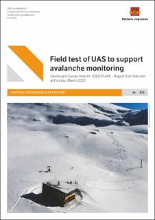
| dc.description.abstract | I mars/april 2022 gjennomførte Statens vegvesen, Norges geotekniske institutt og SINTEF en felttest med UAS med ulike instrumenter på forskningsstasjonen Fonnbu i Stryn. Formålet med testen var å evaluere bruken av instrumenterte droner til overvåking og vurdering av snøskredfare. Instrumentene som ble testet inkluderte optisk og termisk avbildning, laserskanning og georadar. Resulterende datasett inkluderte 3D-modeller (punktskyer og høydekart), multispektrale og radiometriske, termiske bilder og radargrammer. | en_US |
| dc.description.abstract | In March/April 2022, the Norwegian Public Roads Administration, the Norwegian Geotechnical Institute and SINTEF performed a field test with UAS carrying different instruments at the research station Fonnbu in Stryn, Norway. The overall purpose was to evaluate the practical performance of UAS and sensors in field conditions towards the goal of assessing and monitoring snow avalanche hazard. The devices tested included optical and thermal imaging, laser scanning, and ground penetrating radar. Resulting geospatial datasets included 3D models (point clouds and elevation maps), multispectral and radiometric thermal images, and radargrams. | en_US |
| dc.language.iso | eng | en_US |
| dc.publisher | Statens vegvesen | en_US |
| dc.relation.ispartofseries | Statens vegvesens rapporter;873 | |
| dc.relation.ispartofseries | NGI Rapport;20210309-01-R | |
| dc.rights | Navngivelse 4.0 Internasjonal | * |
| dc.rights.uri | http://creativecommons.org/licenses/by/4.0/deed.no | * |
| dc.subject | Drift og vedlikehold | en_US |
| dc.subject | Geofag | en_US |
| dc.subject | GEOSFAIR | en_US |
| dc.subject | Droner | en_US |
| dc.subject | Snøskred | en_US |
| dc.subject | Snø | en_US |
| dc.subject | Lidar | en_US |
| dc.subject | Fotogrammetri | en_US |
| dc.title | Field test of UAS to support avalanche monitoring | en_US |
| dc.title.alternative | Geohazard Survey from Air (GEOSFAIR) - Report from field test at Fonnbu March 2022 | en_US |
| dc.type | Report | en_US |
| dc.relation.project | GEOSFAIR (Geohazard Survey from Air – remote decision support with focus on avalanche applications) | en_US |
| dc.relation.project | Norges forskningsråd: 321035 | en_US |

